Showing posts with label Ordnance Survey. Show all posts

Friday, 31 May 2024

OS Map Reading Week

This will take place in the first week back after half term... we will be doing some suitable activities...


Thursday, 23 November 2023

Ordnance Survey survey on teacher needs

I've been involved with the OS in numerous ways over the years: as a GetOutside Champion, author of support resources for Digimap for Schools and Digimap for Colleges / Mapstream. Also as an author of articles for Mapping News and other support for various campaigns and activities.

For many years Ordnance Survey has delivered support for education to encourage the awareness and use of high-quality geospatial data in the education sector and since 2020 this has been through an Education Plan, funded through the UK Government's Geospatial Commission (GC).
They are keen to gather evidence about how this has so far supported the work of teachers and consider what more they could be doing in this area. 

They would also like to understand what other training tools geography teachers currently access and the barriers that may be in place when using geographic information systems (GIS).


They are asking for 15 minutes (or so) of your time to complete a short survey. 

The survey is open to all geography teachers until Friday 8 December and the findings from it will help them to consider how to develop the Education Plan.

Sunday, 24 September 2023

GetOutside Day


I hope you have something planned for today!

Between 2018 and 2020 I worked as a GetOutside Champion for the Ordnance Survey: part of a team of people in various locations around the country encouraging people to get outside in different ways. Some of them were athletes, bloggers, Instagrammers, runners, paralympians and TV personalities. I was just a geography teacher using my blogging and role to encourage fieldwork and other outdoor activities in the curriculum. We added a Fieldwork Week to my Presidential year, with thanks to Paula Richardson for her efforts there, and expanded it to a Fieldwork Fortnight last year.

There is plenty of advice on the Ordnance Survey's page for this day when people are encouraged to spend time outdoors.

And don't forget to follow the Countryside Code.

Tuesday, 6 December 2022

How has the High Street changed in recent years?


This article and interactive from the BBC News website is particularly useful in helping to answer that question and is particularly relevant for our work with Year 7.

Enter a postcode to see which changes have occurred in your local area.

There is also a useful summary showing the changing fortunes of certain shops and services.

The data has been collected by the Ordnance Survey.

Ely High Street mirrors some of these changes to some extent.

Saturday, 29 February 2020

GetOutside Champions - the end of the adventure

Image

Today is my last day as an OS GetOutside Champion


GetOutside_dual lock-up primary_colour_rgb

I have loved every minute of my time working with the OS over the last two and a bit years, to promote outdoor activity and particularly within the education community. I've enjoyed conversations with the public prompted by my branded gear and equipment, and at various events. I've contributed blog posts and other information to OS websites and blogs. I've been able to offer discounts on OS Maps to hundreds of people, and spoken about the benefits of OS Maps and digital products such as Digimap for Schools and Data Nation. I helped promote the programme at various national and local events, and found myself in the local press several times.

One of the highlights was seeing myself in the pages of the 2nd OS Puzzle Book, this time a trail through the UK, with my thoughts on the East of England.
It's still available from all good book shops, and supermarkets...


A new group of OS Champions has been recruited, and they will meet for the first time next month to start their adventure.

I wish the next generation of GetOutside Champions all the best for their time 'in office' and 'in orange'.

I've made lots of new friends and contacts and will continue to engage on social media, and follow their adventures, and also to GetOutside of course.

The new Champions are in for a great time (and some free swag - I wear my Stance socks almost every day for example)

But for now, it's time to hang up my jacket... 


Monday, 25 November 2019

Digimap for Schools - the new version

This video explores some of the new features in version 2 of the essential Digimap for Schools service. Take a look and see what's changed. New subscribers will have access to this service, and any subscriptions that end will be automatically renewed onto the new service from now on. You can see the new mapping partners on the updated login page shown below:


I had a chance to have a sneak peek and play and the new additions really add an extra dimension to the service including basic mapping of the whole globe, a new Postcodes option and changed tool interface which works nicely.


I will be sharing some new resources and ideas in the coming months, and producing a few of them for adding to the EDINA website. It may be worth revisiting some of the existing resources to see how they might now be enhanced with the new functionality.

Monday, 27 May 2019

National Map Reading Week

It's a pity that it's during the school holidays as we normally do a big push on this at school, and it's sometimes been later in the year.

It's National Map Reading Week, so try to get out there this week with an OS Map and try the downloadable guides.


Perhaps this is the week to do a trial of the OS Maps app - it's excellent...

Merits available to all KEJ pupils who send a picture of them outside with an OS Map.

Friday, 15 March 2019

How to find us

New sign on our Junior classroom door, which should help everyone find their way back here....

Ordered from the What 3 Words shop.

It's always interesting to check back in and see what additional partners What 3 Words are now working with.
These now include Airbnb, and others. They are being used to identify locations in countries where there may be issues with standard addressing systems, or extreme remote places which are off-grid.
Here's an example...

Saturday, 24 February 2018

OS GetOutside Champions

You can take a first look at the new OS Champions Website here.
It will give you information about all the people who are going to be working with me over the next year or more to encourage more exploration of the UK, with all the additional benefits that being outside brings.
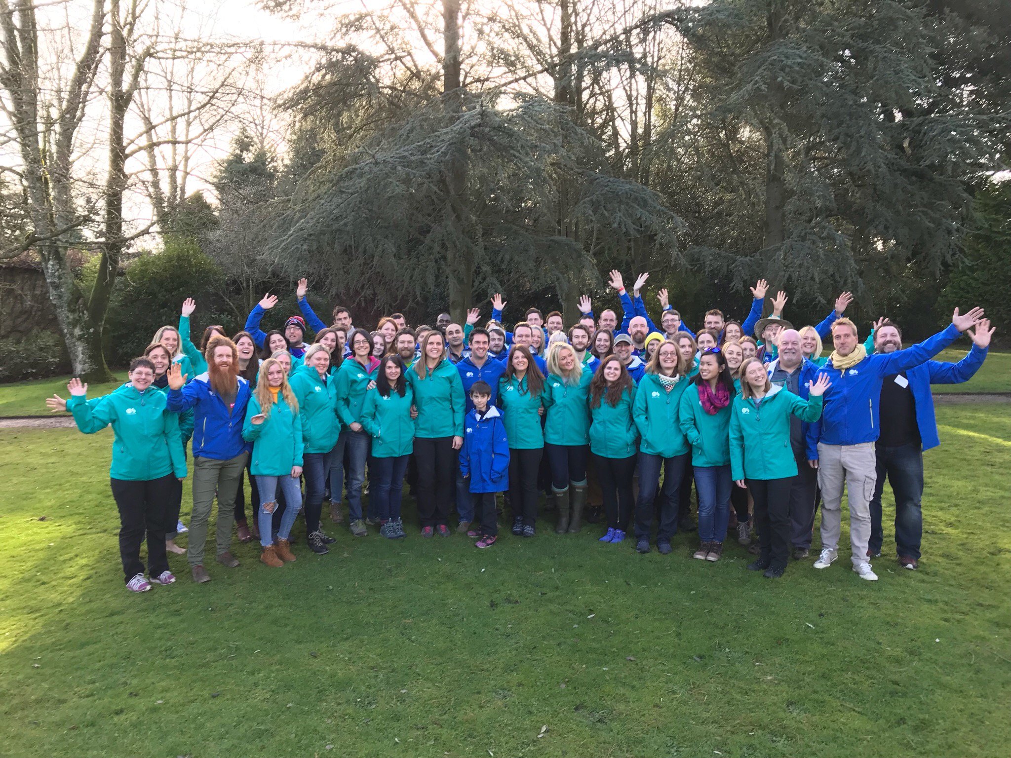
Here's me and my fellow Champions based in the East of England.
We each have a page where we will be posting what we get up to over the course of the year.

Sunday, 28 January 2018

Working as an Ordnance Survey #GetOutside Champion

Back from two days in the New Forest with Ordnance Survey. We were asked to come to Brockenhurst to a nice hotel, where we were to meet with the Ordnance Survey team that supports their core #GetOutside initiative. As you may remember from an earlier post, I applied to be involved for 2018/19 and was delighted to find out some weeks ago that I was going to be taking part, and also that Dan Raven Ellison, who applied independently, was also going to be going along.


We were made very welcome and introduced to the scheme, and given new jackets and boots and various other things. We found out more about OS Maps, and the whole #GetOutside campaign.
We heard from previous and ongoing Champions, and also met Ben Fogle and Kenton Cool, who talked about their plans to climb Everest. Not something that most people can manage, and therefore my work will be far more down to earth, and even below sea level... with an educational emphasis.
We had a photo call: group and individual, and enjoyed some excellent food. In the afternoon, we were set a challenge, and I enjoyed working with the folks on my table: we were placed on a table for the day with other Champions, and some of the other partners involved.

We had a challenger treasure hunt to take part in, and we managed to cover the longest distance by running relays back and forwards for part of the time. Thanks to my team, who are pictured below, and there are also links to their twitter feeds for you to follow.
I'm looking forward to working over the coming year to encourage everyone to spend more time outside during 2018. It's certainly galvanised my own plans for getting outside more. In fact, when I finish this post I'm off out to the local common to get some pictures...

Wednesday, 17 January 2018

Ordnance Survey #GetOutside Champion 2018/19

I'm finally able to announce something which I've had to keep to myself for the last 7 weeks or so...
Back in October 2017, I put in a speculative application to join an illustrious group of people who are selected each year to work with the wonderful folks at the Ordnance Survey to encourage people to #GetOutside and enjoy exploring the amazing variety of countryside that we have in our country (possibly guided with a classic Ordnance Survey map in paper or digital form).
In early December, I received the following e-mail:


There were almost 500 applications last year apparently, and the final list for 2017 included a fair few adventurers, explorers and people who spend their lives in the outdoors, and many of whom are known to millions through their media work. This included Ben Fogle, Sean Conway, Kenton Cool,  Jason Rawles (founder of the Adventurers' Club), and the amazing Sarah Outen.
There were also people who share particular aspects of working outside, or who blog about the outdoors and spend a lot of their time outside, including the Meek Family who were big fans of our Mission:Explore book. There were also people who loved walking, climbing, swimming and other activities, and wanted to share their love of them.
I thought that with my teaching role, my Mission:Explore role, my involvement in fieldwork (I co-wrote a book on it you know) and local place and landscape investigations that I might have something to offer.

This coming year is therefore going to see me getting outside even more than usual, and encouraging everyone to take part in outdoor activities (including pupil at my school, and other schools that I visit), some of which I already have ideas for and others which will no doubt emerge as the year develops, perhaps in collaboration with other Champions. I've enjoyed reading the blogs and tweets from last year's Champions, particularly as they have been reflecting this month on the year just gone and what they have gained from it.

I've been thinking of a few things that I want to achieve during the year, and will be telling you more about those over the next 12 months here on LivingGeography.
I'm looking forward to an event next week when I'll be meeting up with the other champions and finding out a lot more about what we are going to be doing.
I know already that a very good friend of mine is also going to be involved - he'll tell you about his involvement himself.

Here's one of last year's Champions' next venture for example - though I don't suppose I'll go quite that far...

Saturday, 25 June 2016

New OS Map

We have a special new map in the Geography Department, which was made using the Ordnance Survey's Custom Map service. This has been around for some time now, and allows users to create maps which are either flat or folded, with a title and image of their choice. I've got one centred on my village which I won in an OS competition.
We ordered one at the weekend and it arrived within a few days - very quick service. The map is centred on King's Ely, which is great because the school sits right at the edge of the actual map sheet, so it's not very easy to see the surrounding geography. We'll be using it for our new Fentastic Geography unit in the Michaelmas term too.
We'll have it on display at the Open Morning next Saturday, when Year 8s will be displaying their PEPs...


Tuesday, 10 May 2016

Make sure you enter the competition to win a book signed by Steve Backshall

The Ordnance Survey's competition to design a wildlife map is still underway - Primary schools only.
Alongside the main competition, there are 2 prizes of books each week for tweets which are sent with images from fieldwork with the tag #wildlifemap.

This week we sent some pictures from fieldwork which we had taken part in during the week, and posted a picture of a pond on the school site which was showing some signs of being good for newts.

We then had the good luck to be retweeted and replied to by Steve Backshall


We also heard from the Ordnance Survey that we had been successful and we have a signed Steve Backshall book on its way to is. This will be kept as prize for the Year 7 competition which we shall be organising in the second half of the summer term.


Thursday, 14 January 2016

OS Mapskills

Today we used Steve Backshall's videos to remember how to do some basic mapskills.
They are available on the OS website or You Tube channel
Here's the 4 figure grid reference one...


Wednesday, 13 May 2015

One for all KEJ students to have a go at....

Just announced on the One Show apparently...
I was eating fish and chips at the time so missed it...


The One Show / Ordnance Survey Limited “On the Map” Design Competition

We are looking for something visual, original and eyecatching for our judging panel....

We have already run competitions to find the UK’s best chicken curry, chocolate brownies and home-made bread.

Now we want you to turn your hand to designing a map symbol, or several map symbols! We’re looking for your creative ideas in the following areas:

1) Vineyard
2) Skate Park
3) Caves
4) Toilet
5) Art Gallery
6) Electric Car Charging Point
7) Climbing Centre
8) Solar Farm
9) Kite Surfing
10) Ice Rink


All the details of how to enter are here on our website along with the terms and conditions. If you wish to enter a design for more than one category, please send each image in a separate email as your entry might not reach us if you attach multiple designs to one email. The competition is not open to professional graphic designers, map designers or professional cartographers.

Furthermore, as this is a competition for amateurs, entrants must declare any connection with commercial design when entering. Although this will not automatically exclude an entrant, the Organisers will consider any conflict of interest and reserves the right to exclude an entry on that basis.
Entrants are invited to submit a design for a map symbol for one or more of the specified categories listed above. Entries should be sent by email to the One Show email address theoneshow@bbc.co.uk.

Entrants are required to send an image file of their design, no bigger than 10 megabytes. You can create your design on a computer or draw it by hand and send us a photograph of it. We are unable to accept PDF files, but you can submit JPEG, PNG and JIF file formats.

4. Please include your name, a contact telephone number, and a brief description of your design in the body of your email.

5. Please specify which category you are entering your design for in the subject heading of your email. For example if you are submitting a design for an Ice Rink, please put “On the Map – Ice Rink” in the subject heading of your email. Failure to do this may result in your entry not reaching its appropriate judging category and being disqualified.

Entries may be submitted from Wednesday 13th May 2015. The entry window will close at midnight on Sunday 31st May 2015. Entries received after midnight onSunday 31st May 2015 will not be considered.

The designs will be passed over to the OS judging panel, which will consist of their expert map designers and independent judge, who shortlist the entries and will then select the winning design(s) based on the following criteria:

• Originality of design and quality of artwork
• Clarity of symbol – does it clearly represent the category?
• Suitability of design for reproduction on digital and printed maps

The name of the independent judge will be available on written request. The judges may choose up to a maximum of 10 winners for each category. However the Organisers reserve the right, in their absolute discretion, not to choose any winners for any category.

The winners will be notified by the week beginning the 21st June 2015. Competition results will be announced on the One Show on the 1st July 2015, although the Organisers reserve the right to change the date of this announcement. The winner(s) shall receive a bespoke OS map which features their map symbol.

So what are you waiting for? Go and get creative!