"....a distinctive, historic and human-influenced wetland landscape lying to the west of the Wash estuary, which formerly constituted the largest wetland area in England. The area is notable for its large-scale, flat, open landscape with extensive vistas to level horizons. The level, open topography shapes the impression of huge skies which convey a strong sense of place, tranquillity and inspiration. One per cent of the NCA falls within the Norfolk Coast Area of Outstanding Natural Beauty."
There are over 4,000 farms in the Fens; enough wheat is grown here annually to produce a quarter of a million loaves of bread and one million tons of potatoes are grown here. In addition to traditional vegetables, exotics such as pak choi are now cultivated. Some 40 per cent of England’s bulbs and flowers are also produced in the Fens.
I also came across this excellent black and white image via Facebook as well, showing the flooded Fens as they used to be: a wild place, but one watched over by the bulk of Ely's fabulous Cathedral.
Will Fry's Changing Places Substack had a recent post on The Fens: the location for King's Ely. It explored the way that places are represented in order to justify colonising or changing them.
e.g.
William Camden’s Britannia (the Lonely Planet guide of its day), written in 1586, depicted the Fen-dwellers as “a kind of people according to the nature of the place where they dwell: rude, uncivil and envious to all others”. This is an early example of the idea that the nature and character of a place can shape the people in it.
It refers to James Boyce's excellent book 'Imperial Mud' which looks at the landscape of the Fens.
Wherever you are in England you are in one of these areas, which has a particular character.
Each NCA represents an area of distinct and recognisable character at the national scale.
Their boundaries follow natural lines in the landscape, not county or district boundaries.
This makes them a good framework for decision-making and planning for future change.
The information contained within the NCA profiles aims to help guide land management and other activities to strengthen character and resilience, responding to pressures such as climate change.
I was born in Area 38: Nottinghamshire, Derbyshire and Yorkshire Coalfield
I studied in Area 37: Yorkshire Southern Pennine Fringe
I trained as a teacher in Area 41: Humber Estuary
My first job was in Area 69: Trent Valley Washlands
The first home I owned was in Area 76: North West Norfolk and my school was on the very edge of Area 46: The Fens
I spent three years working in Area 37 - Yorkshire Southern Pennine Fringe, when I worked for the Geographical Association.
I now live in Area 84: Mid Norfolk, and my current school is in Area 46: The Fens
To get a deeper understanding of place, infrastructure and community here, we’d like to talk with as many people living in Wisbech, Boston and Peterborough as we can. We want to hear from you the experts about what the strengths and challenges are of where you live. We believe that the rest of the UK can come and learn about the good things happening here as well as the policy solutions we might need to adapt to a changing world.
Imagine you were taking the Prime Minister on a walk around where you live. What makes this place a good place to live? What challenges do you encounter day to day? What can we do about them, together? What can government, local and national, do to help? What power would you like to have in your life, and in your communities, to make things better?
We’re planning to produce a report and short film at the end of 2024 and we’d love your input.
Every day on the way to work in Ely, I pass the turning to Welney Wetland Centre.
This is operated by the Wildfowl and Wetland Trusts, and is famous for its floodlit swan feeding sessions, amongst other things. They are currently involved in Project Godwit: a five-year EU Life funded project that is aiming to secure the future of breeding black-tailed godwits in the UK through habitat management, research, supplementing the population through headstarting, and engaging local communities.
Project Godwit is a partnership between RSPB and WWT with major funding from the EU LIFE Nature Programme, the HSBC 150th Anniversary fund, Natural England, the Heritage Lottery Fund, through the Back from the Brink Programme, and Leica UK.
The project aims to secure the future of black-tailed godwits in the Fens.
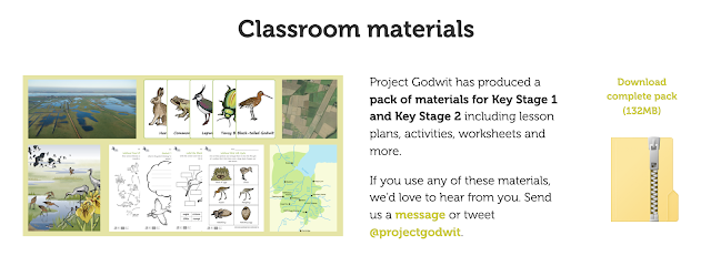
The project has already created a series of educational resources for KS1 and 2 students, which cover quite a few subjects including Geography. They can be viewed here.
They will be perfect for our Year 4 unit on The Fens.
Working in Cambridgeshire, I travel through the Fens each day to and from work, and see the channels, sluices, pumping houses and high banks which have been built over the centuries to keep the water away from the farmland and settlements in the area.
Did you know there is a massive development plan for the arc from Oxford to Cambridge? Meet the #TeamEA embedded in that programme - team 17 in #50teams50days - helping bring massive natural capital benefits to the plan - now that’s a team with a vision! https://t.co/pMprLvSayKpic.twitter.com/zeFdLW73HX
I will be following developments in this area with interest over the next few years while I remain teaching in the area, as it would provide a useful local context for students to explore, and tie in with our work on The Fens.
It's a short film which has been made by Rowan Jaines as part of her work on the Cultural Geography of the Fens. It focuses on the Cambridgeshire Fens, through which I travel on a normal work day and have done for the last eight years.
This video essay is part of a four-year research project exploring the cultural geography of the Fen region in the East of England.
The film is made up of a bricolage of clips of the Fen region, scavenged from the internet and put together in a piecemeal fashion so that the images on screen both intensify and disrupt the linear arc of the narration.
This is a film that aims to show the Fens as haunted by both the past and those things that have not yet come to be.
I am currently putting together an updated unit on the Fenland landscape.
Elements of this will be used in 2021.
This image here is of the 'famous' leaning tree in Ely which I've photographed many times over the years.
The Fens Biosphere project has received funding to support its work and has a new website. It aims to have the Fens declared as a biosphere.
A Biosphere is a special status awarded by UNESCO to a unique and valuable landscape. Biospheres connect people, economies and nature to create a secure future we can all look forward to. They are about developing new ways of living, exploring new ideas and working together.
The key characteristics of the area are suggested below:
The geographical boundaries of the Fens Biosphere have been built around the following key aspects of this landscape:
The peat soils, the ‘black gold’ of the Fens. Within the proposed boundary the dominant soil type is peat, intermixed with silt soils. Peat has become a scarce resource due to ongoing peat loss through shrinkage and fen blows caused largely by intense drainage and farming regimes; there is an urgent need to preserve remaining peat soils.
An important food-producing area dominated by Grade 1 and grade 2 soils; farming and food production are at the beating heart of the Fens. There is a need to ensure farming and the food sector remains vital to the local economy.
Extensive ditch and waterways network: Ditches, the ‘upside-down hedgerows’ of the Fens are renowned for their high biodiversity value, the area being a stronghold for many rare species such as spined loach and water voles.
Internationally important lowland wetland habitats (core areas on map), including Nene Washes, Ouse Washes, Wicken Fen and Holme Fen.
Multiple wetland vision projects, such as the Wildlife Trust’s Great Fen Vision, the National Trust’s Wicken Fen Vision and the expanding RSPB Ouse Fen reedbeds.
Several partnership-led initiatives for landscape-scale conservation in the arable landscape, including the Ely Nature-Friendly Farming Zone and Thorney Nature-Friendly Farming Zone.
Big urban populations acting as ‘gateways’ to the more rural Fens landscape: Cambridge; Peterborough; Wisbech
Historic market towns / small cities in the heart of the area: Ely; March; Chatteris; Whittlesey and Fen Edge towns that will feature in the transition zone such as St Ives, Soham, Ramsey and Downham Market.
Cutting-edge R&D, digital industries and innovative high-tech and agri-tech businesses – some of which also operate in the Fens – in Cambridge, the internationally recognised centre of academic research, and the Cambridge – Peterborough enterprise zone.
The number of academic and businesses dealing with sustainability, climate change and agri-tech developments is vast and still growing.
Will be taking a look at this and seeing which of the activities we could perhaps adopt for our geographical exploration of the Fens, which I am going to beef up a little in the new academic year so that we ground our work in the local area before extending further. Kaitlin Ferguson is the artist here.
Taken from the train - click for full size. One of my favourite images and was used as the basis for a book cover by a publisher. One of the images we shared as part of the Celebrate the Fens Day last weekend.
The Places of Poetry website has launched today.
I mentioned it earlier in the year when I first heard about it.
It is collecting poems which are written about places, which can then be pinned to an interactive map. Click the menu icon top right on the home page for all the details and to add your own poem.
The project has been developed by Paul Farley and Professor Andrew McRae, who says:
“Poetry has been used across the centuries to reflect on places and their histories. We’re using modern technology to reinvigorate this model, and we hope that as many people as possible get involved. We are excited to see where people pin their poems, and what they say about the places that matter to them.”
I went on this morning and added my own poem to the map. You can view and read it here, just outside of the city of Ely.
My poem also has a link to the Ordnance Survey, as it describes the survey of the Fens that was done in 1916, and imagines the challenges facing the surveyors of capturing this fluid and flat landscape with its shifting rivers and streams, only to find that an old Fenland boy spots a mistake. Fast-forward 100 years, and students on a geography fieldtrip, using their smartphones, notice a missing stream on their digital maps...
Why not write / add your own poem to the map to contribute. The map is open for contributions until October, and I look forward to seeing more poems appearing over the next few months.
Here's the poem for those who might like to read it and haven't already...
Year 7 have been exploring some aspects of the Fenland landscape. We are going to be exploring them a little more in the Lent Term.
The Ouse Washes partnership has featured on the blog a few times.They are holding an event in Ely Cathedral which we will try to get along to. The idea of resilience is something we have explored. How does this sit alongside the idea of a distinctive landscape, and maintaining that distinctiveness?
We have been using a film from the East Anglian Film Archive made in the 1940s to compare the changes in the Fens in the last seventy years with those that are likely to happen in the next 30 or so... You can watch it here.
I was interested in the way that the Fens are represented by people, as they are a man-made landscape. They produce a certain response to people.
In books like 'Waterland' by Graham Swift, they are referred to in particular ways, using particular language. I asked people in my PLN to let me know what the Fens meant to them.
Some of them are local, and others aren't - some have family in the area, some live in the area...
This is a Wordle of the responses that I got from people:
Word Cloud generated by Worldle.net Or this Tagul Cloud
I entered a poem in the Fenland Reed Poetry Competitionearlier in the year. I wrote about the Ordnance Survey's mapping of the Fens in the 1920s... and the problem of mapping such a fluid and protean landscape as the Fens... It's a bit clunky, but I enjoyed writing it....
I was really pleased that my poem was 'Commended' by the judge.
I was sent a link to this food map over the half term. Click for the large version
I think the Fens is also a fabulous food region, and Year 7 are going to explore what we produce in our area that could go on a similar map which we can create over the next half term.
Keep food miles to a minimum by researching local food producers.
Here's a few that spring to mind: Corkers Crisps
British Sugar - refineries for beet in the area go to make Tate and Lyle and other granulated sugar
Breweries e.g. Elgood's and other micro-breweries Waterland Organics - veg boxes etc. Fenland Celery (blogged about previously) - G's Fresh Ltd. What else can you find ?
We also have to organise a few other food related things, such as some cooking.
Remember that the first few weeks when we come back are Fairtrade Fortnight. And finally, I hope your food Missions are coming along nicely!!